
Siting or Placement Analysis
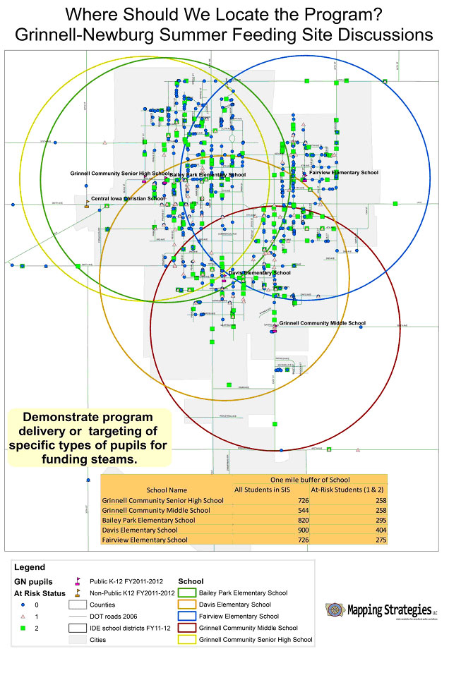
Some clients want Mapping Strategies' traditional geograpic service of selecting a site or place. The below example is where Grinnell-Newburg made a determination on summer feeding program site location by determining which available site had the most students and At-Risk (Certified Enrollment designation) pupils living within a one mile radius.
For clients that have staff for analysis, we offer them the ability to roll around in their own data. For those folks we make data files with our GIS that can be used on freeware GIS such as ArcReader. Clients may study the output and ruminate on different scenarios. You can take time to study concentrations or lack thereof in relationship to what you think is important, at your own pace.